 Snow in
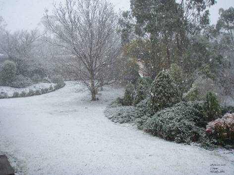
Armidale NSW
Right: University of New England
Sporting Fields with
snow covered hills in the background on 4th July 1984.
Photographed by Simon Smith
Where and When does it Snow?
Outside of the Australian Alps snowfalls on the
Central and Northern Tablelands are erratic and usually short lived. In recent
years winter temperatures in the Northern Tablelands having been slowly rising
resulting in fewer and lighter falls in Armidale.
Often the cold southerly changes bringing snow north of the Alps only make it
as far as the Central Tablelands or the Barrington Tops. On other occasions
snow falls in the southern part of the Northern Tablelands in places like
Niangala, Hanging Rock and Walcha, but that is as far north as it reaches with
Armidale missing out. More infrequently snow will fall over the entire
tablelands and into southern Queensland with the higher areas around Guyra and
Ben Lomond receiving the heaviest falls.
In the early 1960s Armidale averaged almost three days with snow per year. Now
that average has fallen to less than two days per year.
As for settling falls of snow, in the early 1970s the average was about 1.5
settling falls per year. Now that average is down to less than one fall per
year.
The graph shows all snowfalls since 1957. Note the declining trend line.
An analysis of temperatures recorded over the last 40
years at the present BOM East Armidale weather station site shows that in the
early 1980s maximum temperatures over the three winter months averaged just
over 12 degrees. In 2025 that average had risen to just over 14 degrees. The
number of cold wintry days with maximums of less than 10 degrees (usually
caused by cold outbreaks from the south which sometimes bring snow) has dropped
over the same period from 20 to just 6 showing a definite trend towards milder
winters.
Conditions
Required for Snow to Fall
For snow to fall the following conditions
are necessary.
A cold front or "cold outbreak" moving
through New South Wales from the south or south-west consisting of very cold
air from the south of the continent. An upper level pool of cold air is also
often associated with the system. The system must have reasonable amounts of
moisture to generate precipitation.
Winds must be from the west, south-west or south.
Armidale sometimes experiences cold winter winds blowing from the east or
south-east, but these winds very rarely bring snow.
The air temperature must be 3 degrees or lower
otherwise snowflakes will melt before reaching the ground. On some occasions
milder conditions may precede the arrival of the cold air, but it does not
necessarily have to "warm up before it can snow."
The temperature will usually drop to zero degrees or
lower as snow starts falling.
If the ground is cold enough, snow will settle,
usually on grass first, then cars, roofs, bare ground, and cement and bitumen
last. Once there is a layer of snow on the ground further snow will build up on
it quite quickly. Unfortunately snow usually does not fall continuously enough
in Armidale for this build up to occur to more than a minor extent. Snow depths
on the ground of more than two or three centimetres are rare.
Details
of Snowfalls in Armidale since 1971
Below is a list of dates on which moderate or heavy
snowfalls occurred in Armidale.
Only falls which settled on the ground are recorded here. In the earlier years
just the dates are given, but in the later years details are provided on
individual falls.
1971 - August 15
1972 - July 8
1974 - July 8, August 15, 16
1975 - June 12, July 12, 13
1976 - Sept 9,10
1977 - June 30, July 1
1978 - May 12, June 14, 15, July 12
1979 - August 12, 13
1982 - June 20, 21
1984 - July 3, 4 - this was a major event, see separate account below.
1986 - July 9, August 5
1990 - June 28 - snow fell during early hours of morning and there was a light
cover on the ground
until 9am.
- August 3 - moderate fall
from 8am to 12 noon with cover on the ground about one
cm deep. It
melted quickly after 12 noon.
1994 - July 31 - snow and sleet fell intermittently in the early hours of the
morning from around
midnight and
there was a good white cover on the ground at dawn, after which it slowly
melted with
a few patches still remaining in shaded areas at 10am.
1996 - July 13 - moderate fall from 12.00 to 1.20am approx. settling to a depth
of 1 to 2 cms
remaining on
the ground till around 11am.
- August 19 - snow started in
the early morning and continued intermittently throughout the
day. There
was a light cover on the ground in early morning but melted soon after
9am.
1998 - June 23 - 9.30am to 12 noon approx - slight snow showers with snow
starting to settle on
the ground
briefly at 10.15am, but melted soon after. Mostly sago snow.
1999 - August 14 - moderate snow shower from 5.35 to 6pm which settled on the
ground briefly.
2000 - July 27 - moderate snowfall from 8 to 8.30pm which settled to a depth of
2 to 4 cms. The
snow
remained on the ground until around 10am the next day.
2001 - August 26 - light continuous snow fell from 8 to 9.15pm and settled on
the ground, but
melted
around two hours later.
2004 - July 17/18 - light snow from 9pm through to the early hours of the
morning left a patchy
white cover
on the ground in the higher parts of the city. It had mostly melted by 11am.
2005 - June 23 - light showers of snow throughout the day until 4pm. There was
a very patchy
light cover
on the ground in the early morning in some parts of the city which melted
quickly.
2008 - May 17 - moderate snow from 10.30 to 11.10pm settling to give a patchy
cover, but melting
in the early hours of the
following morning.
- July 9 - light snow showers
throughout the day with the best fall from 2.25 to 2.50pm when
large flakes settled on the
ground to give a thin cover which melted soon after.
2014 - July 18 - light snow showers between 7am and 9am. Snow did not settle on
the ground in the
centre of the city, but there was a settling
fall at the university and in South Armidale.
2015 - July 13 - early morning snow showers partly settled to give a patchy
cover in the centre of
the city, a little heavier in South Armidale.
July
17 - light snow during the morning until around 11am. Snow settled to give a
patchy
cover on the ground about 1 cm deep. Snow was
a little deeper in other parts of Armidale.
2019 - August 11 - 8.30-9.15pm - snow showers with snow settling on roofs, cars
and lawns,
remaining until early the
following morning.
2020 - August 22 - 3.15-3.35pm - showers of small hail and snow with ground
partially whitened
2025 - August 2 - this was a major event, see separate account below.
The
July 1984 Snowfalls
Below:
The temperature was -1C when this photograph was taken by
Col Mulquiney at Central Park in the
morning of 4th July 1984
 Without a
doubt the spectacular snowfalls in the New England region on 3rd & 4th July
1984 were the heaviest and most prolonged for many years. Some older residents
claimed they were the best for at least 50 years.
Without a
doubt the spectacular snowfalls in the New England region on 3rd & 4th July
1984 were the heaviest and most prolonged for many years. Some older residents
claimed they were the best for at least 50 years.
An intense cold front pushed up from the
south-west passing through Armidale at around 9am on Tuesday 3rd July bringing
in its wake very cold air and sub-zero temperatures. Armidale's maximum
temperature on Tuesday was 2.6 degrees, and the maximum on the 4th up to
midnight on Wednesday was 1.4 degrees. These were record low maximums. The
minimums were -0.8 degrees and -2.1 degrees respectively.
The snow started at around 9.30am on
Tuesday as the temperature quickly dropped from 2.6 degrees to just below zero.
The snow then continued without stopping for 33 hours until around 6.30pm the
following day. The temperature remained below zero for this whole time allowing
snow to settle and build up to a depth of several centimetres, particularly
overnight on Tuesday. There was a good cover on the ground by late afternoon on
Tuesday, and in the morning of Wednesday all roads in the city were covered. The
New England Highway was blocked at the Devil's Pinch and several other
locations north of Armidale, and it was also blocked to the south at the second
Moonbi Hill. The railway line was also blocked north of Dumaresq. The outbreak
was so intense that snowfalls extended over the border into south-east
Queensland with snow falling in Toowoomba for the first time in 25 years.
The August 2025 Snowfall

2nd
August - Snow fell over a wide area of the Northern Tablelands during the day.
In Armidale a winter wonderland scene presented itself to residents as large
snowflakes fell from around 9.30am. By 11am snow had started to settle on the
ground and there was a thick cover by 4pm, depth on open ground varying between
around 6 to 10 cm. After eight continuous hours the snow stopped at around
5.30pm.
The snow also extended south to Walcha and the Moonbi Range, east along the
Snowy Range to Ebor, north to Guyra, Glen Innes, and across the border to the
Granite Belt with light falls around the Stanthorpe area, and also west to
Bundarra and the Narrabri area. The New England Highway was closed north and
south of Armidale, and also the Waterfall Way east to Ebor due to snow and
fallen trees on the roads. Many areas also experienced loss of electricity for
extended periods due to fallen trees across power lines.
Early the following morning, 3rd August, snow remained on the ground before
gradually melting throughout the day.
The snowfalls were the result of upper level cold air over northern New South
Wales combined with moisture from the east along a surface low pressure trough
associated with an intense low pressure system off the New South Wales North
Coast. This was Armidale’s heaviest snowfall since the big snow event on
3rd-4th July 1984.
From 9.30am for the remainder of the day the temperature stayed between zero
and 1.5C. The maximum (9am to midnight) of 2.5C occurred at 9.00am, and was the
lowest maximum temperature on record for any month (from 86 years of available
records). The previous lowest was 2.6C on 3rd July 1984 recorded at the East
Armidale site, and 2.6C on 22nd June 1949 recorded at the Armidale Post Office.
Above image:
Snow covered driveway and street in North Armidale at 4pm on 2nd August
2025.
© Image by weatherarmidale.com
Snow Photographs
Gallery of snow
photographs on the Northern Tablelands here.
Snow in Queensland
Snow has fallen in southern Queensland on numerous occasions over the last 150
years.
Details and an analysis of snowfalls in south-eastern Queensland since 1878 by
Nicholas Oughton here.
© Compiled and written by Peter Burr. This work is
copyright. No part may be reproduced for commercial purposes without permission
from the author.
Updated 9 February 2026.
Return to Weather Home